Rasterize netCDF4 #
Tools › Rasterize netCDF4 converts a variable from a netCDF file into GeoTIFF rasters. Use it for climate model output or for gridded burned-area products such as GFED.
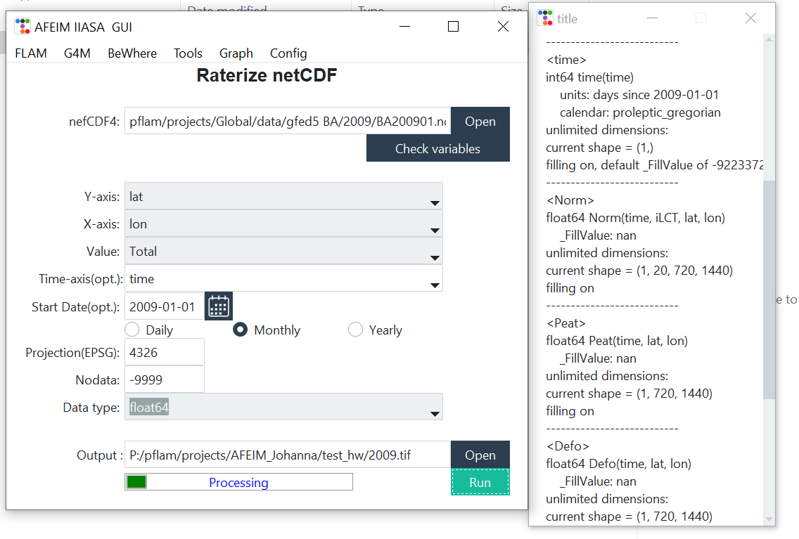
| Field | Description | Default |
|---|---|---|
| netCDF4 | Input .nc file. Check variables lists its dimensions and variables. | — |
| Y-axis, X-axis | Coordinate variables. The tool preselects names containing “lat” and “lon”. | auto |
| Value | Variable to export, for example Total | — |
| Time-axis (opt.) | Time variable. Leave it empty for a single layer. | auto (“time”) |
| Start Date (opt.) | Date of the first time step. Used only with a time axis. | — |
| Daily / Monthly / Yearly | Interval between time steps | Daily |
| Projection (EPSG) | CRS of the coordinates | 4326 |
| Nodata | NoData value written to the output | −9999 |
| Data type | Output data type | float32 |
| Output | Output path and base file name. With a time axis, the tool writes one GeoTIFF per time step, with the date in the file name. | — |
The output stays on the netCDF grid. To align it with your base map, use Configuration › Preprocess or AFEIM.Tools.snap() in Python. Then convert the values to the units FLAM expects (see Input data).